Renewable energy mapping for Africa
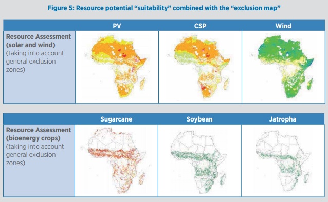
KTH-dESA, lead by analyst Sebastian Hermann, has had the privilege to produce a Renewable Energy Map of every African country for IRENA. This effort has examined the potential for renewable power generation based on resource availability all over Africa. The report presents a practical methodology for translating physical resource potential, as highlighted in the online maps of IRENA's Global Atlas for Renewable Energy (http://www.irena.org/globalatlas), into power generation potential expressed in gigawatts (GW) and gigawatt-hours (GWh). The approach, based on Geographic Information System (GIS) data, can be fine-tuned to cover any country, region or other geographical area.
The GIS-based findings indicate the maximum technical potential for solar photovoltaic (PV), concentrated solar power (CSP), wind power and bioenergy output in all continental African countries. The results reveal renewable energy hotspots and indicate which technologies are most suitable for each country. This is intended to help policy makers develop effective policies and incentives, as well as enabling energy planners to adequately reflect renewables in their master plans.
With the potential for each renewable energy type varying widely, countries and regions need to develop different strategies depending on available resources. Interconnections and coordinated planning within regional power pools can do much to maximise the gains from renewable energy resources.
The final report on published by IRENA

Funding Organisation

